Fort Davis Cyclefest
September 17, 2016
Fort Davis, Texas
Fort Davis, now a National Historic Site, was established in 1854 on the San Antonio-El Paso Road.
From 1854 to 1891, Fort Davis was strategically located to protect mail coaches and freight wagons and to control activities of the Great Comanche and Mescalero Apache War Trails.
A shot of the above mosaic was taken at a rest stop on I 10 and honors the presence of the 24th and 25th U.S. Infantry regiments and the 9th and 10th U.S. Calvary regiments, all-black regiments (known as the buffalo soldiers) who were stationed at the post.
The Fort Davis Cyclefest starts at the Prude Ranch, a resort ranch that hosts different activities year round.

Foreground is David from San Angelo. Tony is in his favorite Alaska jersey as he works there on a two-week on, two-week off schedule.
Rick was not going to ride the 75 mile loop this year as he once again volunteered to help on the ride.
Start of the ride is mostly downhill and through a scenic canyon.
About 5 miles down the road we enter the village of Fort Davis.
Can you imagine waking up and viewing this every day?
The point and shoot shot of downtown Fort Davis does not give justice as it is a quaint, neat town.
Rick, providing SAG, checks out passing people for problems.
Heading out to the foothills, there is a 10 mile stretch of a "false flat". The road is a deceiving 1% incline, either warming one up for the upcoming hills, or wearing one down, depending upon perception. (It wears me down).
Nature provides interesting terrain to distract one from the "climb".
If you study the shot, you can tell the road is still going up.
Just a foreshadow of what is to come as the mountains are still about 30 miles up the road.
Neat gate.
Still going up toward the mountains.
But nature continues to provide distractions.


Confession time. Christine and I had gone 20 miles at this point. (The climb into the mountains is still 20 miles ahead.) We stopped and looked at the nice decline, but realized if we went any farther, we would just have to climb up. So we turned around and were content to do just 40 miles. Had we prepared for the 75 mile loop? No.
So, as we were going to get to enjoy the 1% DECLINE back to town, we just enjoyed the scenery.
If we saw something interesting, we would just stop and look.
Yucca and sotol.
Yucca again.
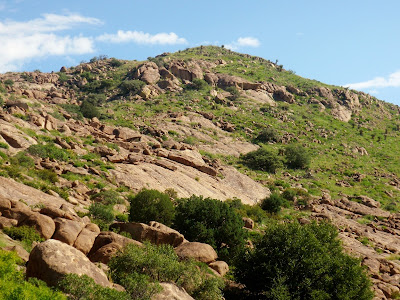
On the way back, we stopped at Rock Point and took a series of shots.
Rock Point is a rest stop with picnic tables.
Christine admires Rock Point at the entrance.
The previous Yuccas were straight. This leaning one is interesting.
Soon, it was time to leave this restful stop and continue our journey.
Since Prude Ranch to town is downhill, guess what the return is?
Nice shot--and glad I cut my fingernails before the ride.
Another highlight of the ride. The hosts provide hamburgers and drinks for the riders. Good food and good company tops off another great weekend.

Foreground is David from San Angelo. Tony is in his favorite Alaska jersey as he works there on a two-week on, two-week off schedule.
Rick was not going to ride the 75 mile loop this year as he once again volunteered to help on the ride.
Start of the ride is mostly downhill and through a scenic canyon.
About 5 miles down the road we enter the village of Fort Davis.
Can you imagine waking up and viewing this every day?
The point and shoot shot of downtown Fort Davis does not give justice as it is a quaint, neat town.
Rick, providing SAG, checks out passing people for problems.
Heading out to the foothills, there is a 10 mile stretch of a "false flat". The road is a deceiving 1% incline, either warming one up for the upcoming hills, or wearing one down, depending upon perception. (It wears me down).
Nature provides interesting terrain to distract one from the "climb".
If you study the shot, you can tell the road is still going up.
Just a foreshadow of what is to come as the mountains are still about 30 miles up the road.
Neat gate.
Still going up toward the mountains.
But nature continues to provide distractions.


Confession time. Christine and I had gone 20 miles at this point. (The climb into the mountains is still 20 miles ahead.) We stopped and looked at the nice decline, but realized if we went any farther, we would just have to climb up. So we turned around and were content to do just 40 miles. Had we prepared for the 75 mile loop? No.
So, as we were going to get to enjoy the 1% DECLINE back to town, we just enjoyed the scenery.
If we saw something interesting, we would just stop and look.
Yucca and sotol.
Yucca again.
On the way back, we stopped at Rock Point and took a series of shots.
Rock Point is a rest stop with picnic tables.
Christine admires Rock Point at the entrance.
The previous Yuccas were straight. This leaning one is interesting.
Soon, it was time to leave this restful stop and continue our journey.
Since Prude Ranch to town is downhill, guess what the return is?
Nice shot--and glad I cut my fingernails before the ride.


No comments:
Post a Comment