
Piney Woods Purgatory
October 1, 2016
Lufkin, Texas

As always, a good crowd. The start location was a new one to us, but we were guided there with GPS. Without getting ahead of the story, suffice it to say that I wish I had GPS upon the return.

The first 5 or so miles are really easy, either flat or slightly downhill. So one wonders what is purgatory about that. I think I have told the story, but our first year at the ride, I was looking at a route map and asked a local which hill was "Purgatory"? He said, "All of them." There is always one more hill, and that is purgatory.

Right on cue, the first hill we come to is a doozy. Over 10% and goes forever. Great way to warm up for what is to follow.

An never-ending series of inclines.


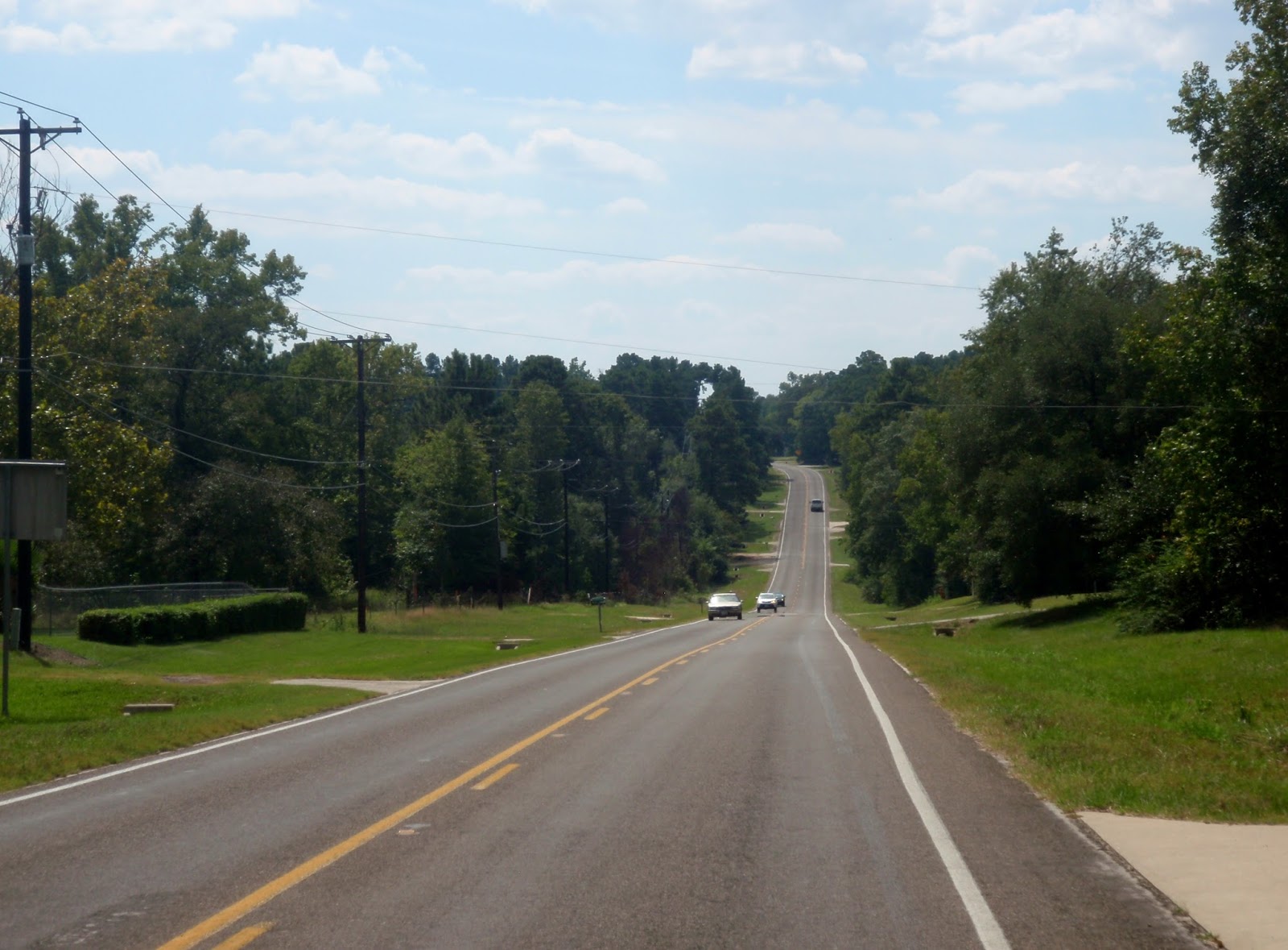
How can it be "purgatory" with such scenery?

Eventually the terrain flattens a bit.


And then you get to rest. Great cookies.

After this decline, one gets to settle back and enjoy a few miles of roadside beauty.


Sweet Union Baptist Church is just about all that is left of Sweet Union, TX. It once was a thriving community with a colorful past, but now it boasts only about 40 residents.


Another welcome rest stop. Thank you volunteers.

You decide and I will just keep quiet and try to stay out of trouble.


Last rest stop before the finish. Bicycle racks were a nice touch. Thanks.
One of the "last" hills before the finish. Now the story I alluded to at the beginning. At the "end", there were arrows pointing right. So I turned right. I had noticed some riders turning left but figured they would turn around upon discovering their error. Well, after about miles beyond my projected distance of 50 miles, I began to notice familiar looking areas. I was on the route at the start of the ride, NOT THE END. I stopped and asked some local how to get to Henderson Coliseum. "Oh, it is way back yonder." Three people gave me slightly different ways to get there, so I just took off and figured I would just use dead reckoning. Didn't work. Eventually, I would stop at a stop sign and wait for a car to stop and ask them for directions. I would follow those directions for a while and then stop again. Just as I had exhausted my patience, I was back at the point that I should have turned left. Lesson learned? I won't know until next year to see if I make the same mistake(s).
Christine's war story: At some point during the ride she flatted. Not wanting to change the tire, she waited for the SAG. Unfortunately, the SAG driver was not a biker and didn't know how to change the tube. He was following the last rider on his route who was VERY slow. Christine waited at the rest stop for other SAG guys who also didn't know how to change a tire. She talked them through it, though, but that delay threw Christine way back in the pack. She did not make the same mistake that I did near the finish and was not the last of the 50 milers to come in. Lesson learned. Stay close to me so I can change her tires.


