Grape Creek
San Angelo, Texas
March 25, 2017
Grape Creek is a little community just outside of San Angelo. It is one of the favorites of cyclists as it has good roads, few loose dogs, a lot of flat areas, and just enough inclines and rolling hills to keep one interested.
Smooth, smooth road in the elementary and high school area. I wish Texas and Tom Green County would use this pavement company. It is like Hwy 277 USED to be.
As we left Grape Creek, the roads were still good.
Off to the left is Bean Hill, elevation2290 feet.
Example of long incline. Not steep, just long.
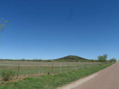
Coming up on our right is Mt. Nebo, elevation 2329, reportedly the highest elevation in Tom Green County.
After intersecting with March Road, there were a lot of rolling hills, one up to 10% per my Garmin.
As "always," one has to take my word for the rolling hills as my camera insists on making the roads look flat.
To prove a reverse point, upcoming was a good long decline...that looks flat.
After a few more rolling hills, March Road is a steady decline back into Grape Creek. When we got to Grape Creek, half of the group wanted to do the circle again, only this time take the road that has Mt. Nebo on our left side.
Unfortunately, there were very few wild flowers on the route and I had to stop and take this picture in order to make sure I captured them.
Mt. Nebo coming up on our left side.
After intersecting with March Road once more, the road becomes a decline--but you will just have to take my word for it.
Turning on Wren Road to go back to Grape Creek proper, Mt. Nebo can be seen off in the distance.
Wren Road before intersecting with Grape Creek Road is flat as depicted in the photo. Finally an accurate shot just before the end of a very nice ride with a great group of riders. Undoubtedly, we will ride this route again this summer.


No comments:
Post a Comment