
Z Tour
Princeton, Illinois
July 18, 2015

At the staging area, one would think we were in East Texas. Big, beautiful pine trees.

Christine was excited and ready for our journey.

And, well, I was there.

Off we go.
Illinois corn fields and terrain are flat. Right? At the offset, let me tell you about the terrain around Princeton. Compulsive people do compulsive things, OK? Well, we did the 65 mile route. Using my Garmin download, in that 65 miles I counted:
100 climbs
19 of those were 8% or greater
13 of the 19 were 11% or greater.
The steepest that I glanced down at while riding topped at 15%.
Yet, as I have complained many times, when I take a picture of an upcoming hill or downhill, it looks (yawn) like a speed bump coming up.

Instead of trying to wow you with a lot of inclines/declines (although I will attempt to do so), at first let's concentrate on some of the beauty of the ride. Of course, I am speaking of Christine rather than the impressive cornfield in the background. (Editor's note: With 90+% humidity I wasn't feeling beautiful--but what a sweet thing for my hubby to write.)
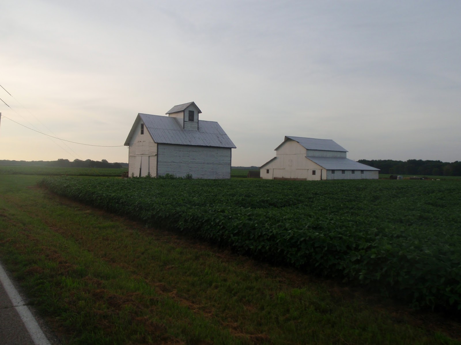
Forget the house, barns are the focus.

Add the house and you have an idyllic, country setting.

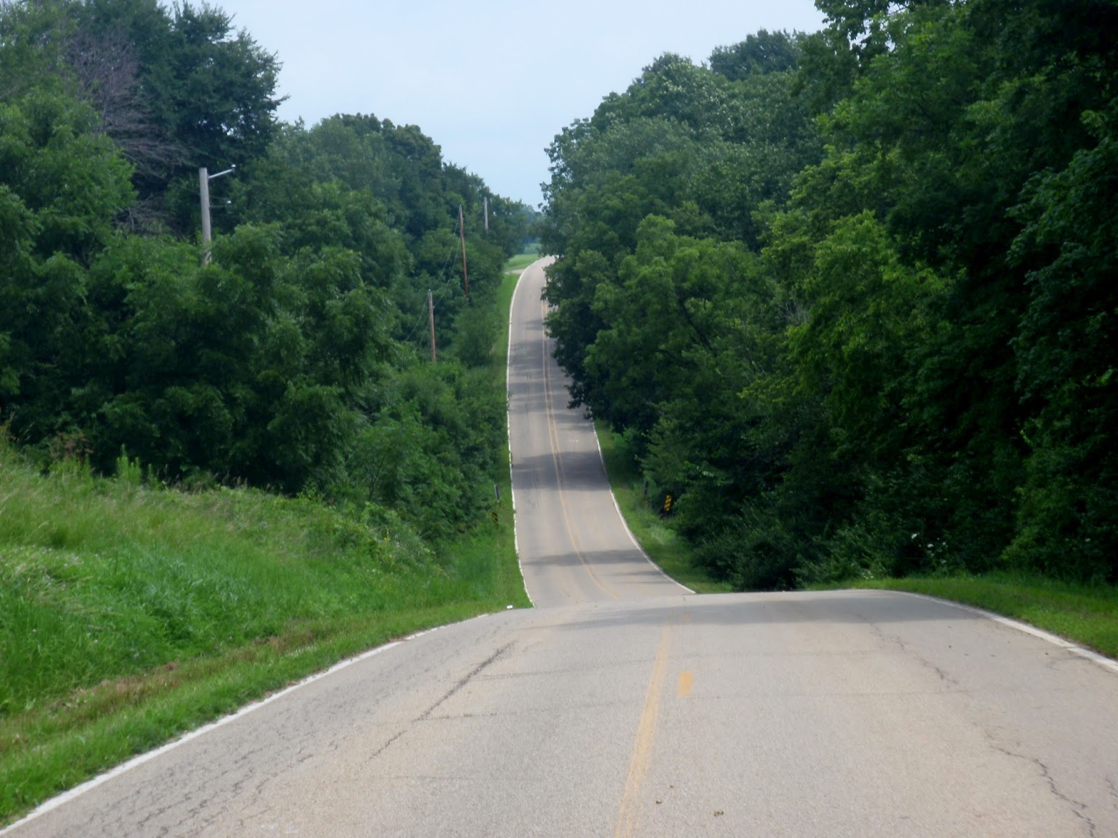
Corn field on the left, soy beans on the right. And a little speed bump coming up that will probably not get over 6%.

Lakes are full as Illinois had recently received a lot of rain.

Hennepin Canal lock was at a rest stop along the way. The man-made channel connects the Illinois River with the Mississippi River. Construction began in 1890 and was completed in 1907. The canal shortened the distance for river travel by nearly 500 miles.

The route continued along scenic roads.

Good directional markings.

Good sense of humor. Don't say they didn't warn you.
Whee. (Enlarge this to full screen and it will take your breath away),

Good advertisement as well as providing directions.

Entrance to Lake Thunderbird. The area was significant for several reasons. It had "outstanding" hills (this area had the 15%'er), one of Christine's sisters lives in the settlement, and we stayed at a B&B in the community. And it had lots of deer, turkeys, song birds, and hummers. And plenty of raccoons (inside joke).


About to leave the Lake Thunderbird area.

Back to farm land and the rolling hills. As I recall, the upcoming "rolling hill" topped at 11%.

I think this was a little 8%'er.

Don't ask. It was steep.

It may not look it, but the roads were very good and bike friendly.

Rest stop favorite at Tiskilwa, Ill. Water spouts to cool riders off.

Christine is trying to fake it. Actually the humidity was stifling. Recent rains' presence was still being felt. Note the lady behind Christine. We saw a lot of people who couldn't continue and the humidity was the culprit.

Back to more scenic terrain.


Railway trestle over the Hennepin Canal.

At nearly every canal crossing, a picnic area was available for people's pleasure. Some of the 155 miles of bike/hike trails are on the left.

Back to the rolling hills.

This was a welcome rest stop in Wyanet, Ill. Not only was it air conditioned, but they had good food, too.


As one can imagine, this was a good down hill. A reward for getting to the top in the first place.

Good place to end. Lead picture is also very close to the end of the ride. This is one of two covered bridges in Bureau County. The other one, which we later drove to, is the "famed" Red Covered Bridge.
Synopsis of the ride: excellent roads, great volunteers, plenty of hills (if that is your preference), outstanding scenery, good rest stops, and did I mention great volunteers? They had generous slices of pizza and drinks at the end of the ride so no one would go home hungry. It may have been a seasonal fluke, but they can have the humidity.
Would I go back and do the ride again--in a heart beat!!!


I grew up near Chicago, and can vouch for the summer humidity. Looks like a great ride.
ReplyDelete