Sunday, May 26, 2013

Palermo, Sicily

Palermo, Sicily
In the background is an example of the rugged hill side that characterizes Sicily. Sicily is the "football" that the toe of the Italy boot kicks. However, the Sicilians are not easy to kick around as depicted in The Godfather.  
The guide for the day. At Palermo, we decided just to go on a short walking tour. As such, all we needed was a city map--and a person able to read the map.
Palermo has a reputation of being a base for the Mafia. In the past, gang violence was prominent, and murders were committed in daylight on the streets. But today, Palermo welcomed visitors with outstretched arms.
Christine guided me past a lot of old buildings, but we had since discarded the map, so I can't say what the buildings were. Other than old buildings, that is.
My point.
At first, I thought I was taking a picture of an old church. It probably was, but interestingly, the sign stated that it was a military zone and access was restricted.
A more pleasant scene.
Another church but not fenced in.
 Graffiti. I can't say that graffiti originated in Italy, but I can say that the word graffiti is from the Italian word graffito ("scratched"). Graffiti is applied in art history to works of art produced by scratching a design into a surface. Today, it is "art" produced by spray paint and colored markers.
Walking along a street, we spotted a building that looked interesting on the next street so we headed that direction.
This house was along the alley--or street--going to the building. It was the only air conditioner that I saw on any house on the routes that we took. It was running full force as it was really hot that day.
The mysterious building turned out to be their post office. 
Another building that I just liked. 
Our destination for our self guided tour--San Domenico Church. Constructed between 1458 and 1480, the Baroque facade is gold and white, with twelve columns and statues set in niches.
 On the  plaza in the front of the church is a towering column with a cloaked figure atop it. It would be even more impressive, but it is now in the middle of a large parking lot (cars cropped out for your viewing pleasure).


 We made a brief tour of the inside of the church. Besides being huge and pretty, it was a lot cooler inside the building.


 As our self guided tour was ending, I took one more shot of the church as it was really impressive.

But we had to hurry back to the ship for
The last formal night (the 6th of the cruise). While we were enjoying the formal night, the ship silently headed toward Naples.

Incidentally, we had a guided tour lined up for Naples, so I will be able to explain more about what our guide told us than today's guide told us. 

Sunday, May 19, 2013

Cross the Basin

 Odessa, Texas
May 18, 2013
This was the first time this particular event was organized and it was a very good ride. I am forward to the 2nd annual Cross the Basin. The "basin" refers to the Permian Basin where Midland and Odessa are located--site of an ancient inland ocean where oil and natural gas have been produced since the 1930's.
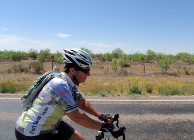
 Christine and I had a slightly late start so we hurried to try to catch up to the main group. It was such an effort just to try to keep up with Christine that my heart rate went all the way up to 126 beats per minute. (I say this as my heart rate on routine rides averages between 108-112). My medication really works well!!
 Finally, we passed a few of the recreational riders and settled in to the first leg of the ride along the frontage road of Interstate 20. I20 is under construction and the trucks were starting to back up along the route.
 Then we turned onto FM 1788, and into the wind. A day or so before the ride I checked the forecast, and a SSW 10 mph was predicted. I told Christine and we were overjoyed with the slight wind--piece of cake.
 Well, we were into an 18 plus wind with no wind breakers. The mesquites were about head tall so they provided no break.
 Good ole pump jacks were everywhere. Bad ole oil trucks were everywhere. They were in a big hurry to get where ever they were going. Most gave us a pretty wide berth.
 Then we turned onto Dora Roberts Road as you can tell by the change of scenery and terrain.
 I did spot a couple of clumps of small trees. Even though they were small, look at the contrast with the surrounding mesquites.
 Miss happy face. I was unable to get the usual smiling happy face of Christine on a ride. There are two things she hates, chip seal roads and high wind in the face. She was getting both. (Editor's note: In addition, my saddle turned into a brick about 15 miles earlier.)
 I took this picture to show that we were about to turn onto Cities Service Road--and wind to our back!!
 Unfortunately, the road with the wind to our back was short lived. 
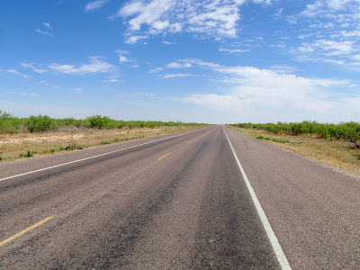
 One can tell from which lane I took this shot. The shoulder was pretty rough so we listened carefully for cars and trucks coming from behind.
Glancing back over the ride pictures, I took most of the shots on level terrain. The route did have some rollers, and at one point my Garmin registered a 5% and 7% climb, so it wasn't completely flat terrain.
 The ride had started from the University of Texas Permian Basin, so after the ride we took in the sights around the university. Above is a duck pond and a young rider feeding the "spoiled" ducks and geese.
 This Stonehenge replica is located near the Arts Center. The stones are just 3 feet shorter than England's Stonehenge. It was placed on the campus as a tourist attraction and as an explanation of ancient astronomy.
 The campus has a nice cactus garden. This one is a metal sculpture well over 7 feet tall. One unusual thing about the photo is the "UFO" in the upper left of the picture. When I enlarged it on the home computer, I thought I could see two aliens peeping from the upper dome.
 A huge cactus cluster. And the above comments were to see if one is reading the post or just looking at the pictures.
Prickly pear cactus in bloom. 
 The agave plant, commonly know as the century plant, is part of the desert flora. When I was growing up, I was told that they were called century plants as they only bloomed every 100 years. I believed that until we lived in El Paso's high desert. The plant lives only 10-30 years so it is slightly misnamed.
Young agave plants spring up from the seeds blown from the mature plant's flower stalk which grows up to 26 feet (8m) tall.
 
With the tour of Cross the Basin and the UTPB campus finished, we headed back home. We have discussed returning to another event after Christine gets a softer saddle. The wind blows year round, so a new saddle is our only draw back.  


Sunday, May 12, 2013

Tunis, Tunisia

Tunis, Tunisia
As our next bicycle tour is not scheduled until next weekend, we will continue our Mediterranean tour and our stop at Tunis.
Tunis is the capital of Tunisia, the northernmost country in Africa.

The city feels neither Arab nor African. It is a place where the old and new mix without any seeming conflict. In the background from the docking area, one can see new buildings, old buildings, a mosque and to the left a church steeple.
The architecture has Moorish and French influences and way of life, complete with camels.
There are remnants of Roman influence, at least in the Roman (?) band that greeted the ship.
Tunis is the largest city of Tunisia with a population of over 2 million. On one corner you might see women with traditional head covering. On another, you might see girls in tight jeans and tops.

My point?
(Women have not had to cover their heads in Tunis since the mid-1980's).
Our tour passed by the Vincent De Paul Cathedral on the Place de L'Indepencence. Vincent De Paul was a Catholic saint who came as a slave to Tunis who helped other Christian slaves after earning his freedom. The Cathedral was built in 1882 and is one of the largest remnants of the Colonial era. The architecture of the Cathedral is ofter described as being grotesque, and it does seem quite out of place. However, the Cathedral was built by the French living in a predominantly Islamic country and the architectural style reflects this odd situation.

The Tunis government buildings have a little more "modern" look to them but is still a mixture of architecture.
The country was still in a bit of turmoil, and barbed wire barriers were around many of the government buildings. 
Christine does not seem to be concerned with the political situation. What you will not see in these pictures are shots of the soldiers, police, or guards in the area. It was taboo to take a picture of them. We were not told of the consequences, just not to do it.

I am sure this door is meaningful and symbolic, but to me it was just pretty.

As was this apartment that made the alley a dead end.

But just turn around and there was the Mosque Sidi Youssef. It is the oldest of the four Turkic, octagonal minarets of Tunis (minaret is a distinctive architectural feature of Islamic mosques, generally a tall spire with an onion-shaped or conical crown).

Another government building (I forgot what function was housed here, but it was pretty).

Part of the aqueduct system of ancient Carthage. It supplied water to 24 cisterns near the Byrsa Hill, where the city of Carthage was first erected.

The headquarters building of the Tunis channel, i.e., the national TV channel of the government.

Carthage is a suburb of Tunis with a population of 20,715 and was the center of the Carthaginian Empire in antiquity. The city has existed for nearly 3,000 years, developing from a Phoenician colony of the 1st millennium B.C. into the capital of an ancient empire. Above are some of the ruins of the original city. 

Aqueduct into the city.

Part of the cistern system.

Carthage has a long impressive history. It became Rome's fourth most important city and the second most important city in the Roman West. It remained one of the most important Roman cities until the Muslim conquest when it was destroyed a second time in 689.
One can not discuss Carthage without acknowledging that Hannibal, one of the greatest military commanders of history, hailed from Carthage. One of his most famous achievements was at the outbreak of the Second Punic War when he marched an army, which included war elephants, from Iberia over the Pyrenees and the Alps into northern Italy. 

  Politics, politics. It was mentioned above that Carthage was destroyed by the Muslims long ago. Some of the guide's story is vague, but what I remember is that the residents of Carthage might still have a resentment. The Muslims wanted to build a Mosque over ruins of world heritage importance and were denied by the UN. A powerful politician allowed the building of the above Mosque over the objections. I think the guide ended the story by pointing out that the Mosque was not supposed to be there.  
More ruins as we were leaving the area to-----
go shopping!! Hannibal on one of his trusty elephants welcomed us into the shopping area.

I don't remember what Christine bought, but I wandered outside and took a picture of some of the wares for sale. The owner of the stand "knew" I was interested and followed me onto the bus trying to get me to come back and buy something. (I wisely left the shopping to the expert).
Next we went to the North Africa American Cemetery and Memorial.
The cemetery and memorial was beautiful and well kept. The cemetery layout is similar to the Arlington cemetery in Virginia, as the white crosses commemorate the fallen American soldiers who fought in north Africa beginning the Allies' push against Nazi Germany. There are 2,840 crosses and a Wall of Remembrance to the 3,724 who were never found. This is also a great marble map with the battle plan, showing how the offensive was carried out.
Then it was time to return to the fort-on-the-pier.
With the continued blend of old (Arabian village) and the new (our ship).
Too bad the blog does not have sound. Christine joined the band and produced the Arabian ululation women make during celebrations. (A skill from her long ago belly dancing days--which is another story).
 
And then it was time to get back on the ocean liner for another adventure.