Fort Davis Cyclefest
Fort Davis, Texas
September 19, 2020
Officially the Fort Davis Cyclefest was cancelled this year. However, a large group of people showed up anyway and all did their own thing--hence "a la carte." As such, there was no staging area, no set time to ride, no imposed direction to ride, no rest stops, no official SAG, and NO T-SHIRTS.
Christine, Brian, and I decided upon a reasonable start time when it was neither chilly nor hot. And we chose to begin at Crows Nest about 15 miles out of Fort Davis. We would be traveling clockwise. Also, besides cutting out the 10 mile false flat incline, the route would get us into the mountains quickly.
Another benefit starting from the Crows Nest is that it marks the beginning of a nice 9 mile downhill stretch of road.

Crows Nest is on the far left under arrow.
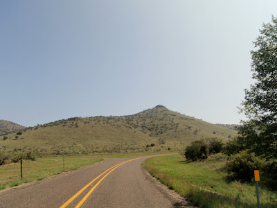
A few slight inclines but mostly down.
Kent-Valentine fork. We go Kent.
This sign tells us "just" 49 more miles to Fort Davis, but what a 49 miles.
False flat decline.
Christine was going to do a shorter route, so at the starting point she had left us in the dust. On top of a roller, she stopped and waited for us. Some may recall many years ago when we were first starting to ride, she had stopped to wait for me to complete the climb. As I was struggling with my head down, I failed to see her and plowed right into to her bike. Of course, I fell and cut my ankle on something. If that wasn't bad enough, a couple was behind us, and, although they were pushing their bikes up, when they saw me fall they gave me a good teasing. Traumatic things you remember a long time.
Downhill continues. Sawtooth in the far distance on the right.
Eventually, we get to small rollers.
Met Christine on her out and back ride. She had planned on turning around at the "unofficial rest stop," but she had passed it and realized by the effort involved that she was starting the Bear Mountain climb before she turned around.
Unofficial rest stop. Not sure what happened to the large tree that used to be there. "Unofficial" because there was no support there. Leading up to the point is a long steady climb. Legs already burning, but one knows that Bear Mountain is coming up. Then you would see a lot of bicycles on the left side of the road, so you would rejoice that a rest stop is near. But it was just other riders resting, refreshing, and girding up for the long climb ahead. Official or not--stop.
Right after the rest stop the Bear Mountain climb begins.
One can argue that the Bear Mountain climb is from the 35-45 mile marker, but we generally count the 40-45 markers which mark the constant 6 to 8 degree climb. Christine's non-pc name for the mountain is Bi--- Mountain.


Normal spot for the Bear Mountain Rest Stop. The cars were wives SAGing for their husbands. They were very friendly, and if we were stopped for whatever reason, they would slow down and ask if we were alright and needed anything. One guy from San Angelo said he got a Gatorade from them and really appreciated it.
Sawtooth in the distance at the Bear Mountain rest stop.
Start of the decent from Bear Mountain.
Not too many pictures of the decent as I was busy holding on and riding my brakes. One will see why a little below one of the pictures.
This is the Ken-Fort Davis split. Below shows where we are and why I was choking my handle bars.

At the curve marks the beginning of the Fisher Hill climb. I used to describe it as short and steep. This year it was long and steep.
The lone rider back there was Brian.
No pushing the bike for Brian, he is too good at pushing his pedals.
Looking back and one can see our start with the little ribbon of road left of the highway.
All was well again with a long downhill decent.
Beautiful day. Not hot nor chilly. And note the flags at the ranch entrance; no wind.
Riders approaching going counter clockwise. There were a surprising number of riders out for a "cancelled" ride.
Good downhill.
Then the omen of another climb coming up.
Mt. Lippe. Also steep and winding.
We top Mt. Lippe, but recall that the "top" had a lot of rollers until we get to the McDonald Observatory.
The point in which one now has hope. Neatly framed in the background are the Observatories. After the Observatories it is down, down, down. (Remember the Mt. Locke Race route--it was up, up, up.
If one looks real hard, the Observatories are sitting on the mountain in the background.
While we were still on top going through the rollers, Christine started SAGing for us. She had finished her ride and reversed the route to meet up with us. Thanks, but I don't need a lift yet. Especially when we are near our long steep decline.

One needs to test the brakes before starting this decent. Not only is it steep, but it has a lot of sharp switchbacks. One side of the road may be solid rock and the other side may be a steep cliff. Some have guard rails, but that may stop the bike, not the rider.

Just as we are on level ground and think the ride is about over, note what is looming in the background.
Heart Break Hill.

Smooth sailing.
Prude Ranch. In a normal year, this would be our staging area and start-finish line. But since this was a chaotic year, we were headed toward town and our hotel.
Rolling down through the canyon.
State Park entrance coming up.
Fort Davis National Park coming up.
Just at the edge of town.
My favorite eating place in Fort Davis. Just across the street from Limpia Hotel, the drug store has the best chocolate milk shake--and big scoops ice cream cones. Perfect recovery supplements.
It was a good turn out for a cancelled ride. We wish more from San Angelo had attended but we have reservations for next year and will be there whether the ride is formal or on your own. Either way, it is a real pretty and challenging ride.
Map of the ride. Iconic to the jerseys and T-shirt, each has the map and elevation on the back of the item. So, if you buy one of their jerseys, you always have a cue card to let you know where you are in the ride and what is coming up next. Neat.


 One needs to test the brakes before starting this decent. Not only is it steep, but it has a lot of sharp switchbacks. One side of the road may be solid rock and the other side may be a steep cliff. Some have guard rails, but that may stop the bike, not the rider.


