Fort Davis, Texas
Line up was at the Prude Ranch, or, from your hotel. I chose the hotel start line. Right out of Fort Davis one embarks upon a long relatively straight ride. The road is a false flat. For the first 10 miles, the road is from 1-3%, and of course this particular day the wind was in your face. As a matter of fact, it was in our face most of the day, but I will have more to say about that later.
I had started a little earlier than the ones from Prude Ranch, but guess who pulled up at rest stop 1 right behind me? Brian who had started at the Prude Ranch. I could already tell, don't look at your odometer or average. It doesn't take a Garmin to let you know you are slow.
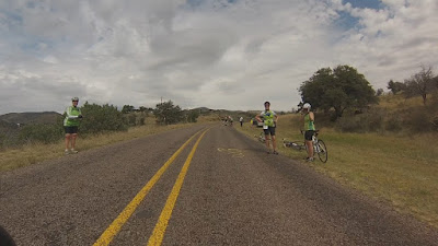
More of the "flat" road but one can start seeing the target off in the distance.
Slowly, (no pun intended), the views become more scenic.
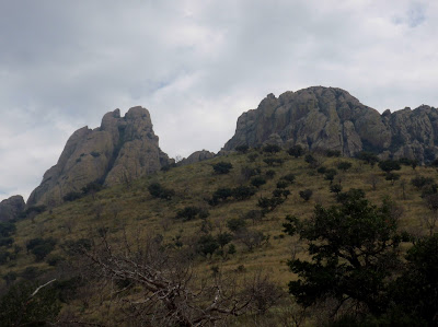
Not a rest stop, just riders stopping to enjoy the red granite outcrop.
The mountains are getting closer.
Rest stop 2. What is missing from the above photos are a nice long downhill, and two porta-potties in the middle of nowhere that were supposed to be at this rest stop. Some of us saw the lonesome porta-potties and of course stopped. Others, (most), ASSUMED that this rest stop would have the porta-potties. Luckily, there were some cement barriers for road construction that provided some privacy for the surprised riders.
Rain had been predicted. I went through a sprinkle. Tony said he got soaked in a shower. However, for the most part, our greatest environmental struggle was with the wind.
Twice along this stretch, I stopped pedaling and was rapidly pushed to a halt by the wind. Had to keep pedaling even on small declines.
Slowly coming upon the start of the incline for Bear Mountain. In the foreground is still evidence of the wildfires of some years back.
One may get the idea that the approach to Bear Mountain is a decline. That is not the case, it is just easier to take a picture when approaching a slope.
Jeffri at rest stop 3. Saw Tooth Mt. in the background.
Part of the San Angelo "gang". Christine, Jeffri, Roy, and Robbie. Tony, Brian, Marlon, Hector and group are probably at rest stop 5.
Rick had agreed to be a volunteer for the ride and was one of the much appreciated SAG crew. The rest stop was at the spot that we had always referred to as the unofficial rest stop. It just had picnic tables but most of us would stop and catch our breath before the final mile and a half of Bear Mountain. It was another case of the porta-potties being placed at the wrong location, so the ride directors adjusted and had the rest stop here.
This and the next few pictures are where the Bear Mountain rest stop is usually located.
For people who have ridden the Fort Davis Cyclefest, they will have noted that there was a big skip in the ride from the rest stop to this location. That is because I had both hands on the handle bars struggling to get up Bear Mountain. Maybe I can demonstrate in a later posting using the GoPro.
One of the rewards of climbing Bear Mountain--you get to go downhill for a while.
Joy ride over. There has been a big skip again in the ride. Above is part of the Fisher Hill climb. A real toughie with winding inclines, and as you make another curve, more inclines.
EVENTUALLY, one is rewarded by another downhill adventure.
After struggling through a series of good rollers--the light at the end of the tunnel. When one can spot McDonald Observatory, Prude Ranch is only about 13-15 miles out.
The McDonald Observatory sign marks the beginning of another long, steep decline. It is one of the most talked about declines of the ride.
While we are having fun on the downhill, the reverse (uphill) is what the Sunday Mt. Locke racers must contend with in their 7 1/2 mile race.
Don't come around the corner too fast. The barrier will not stop you.
Hard to see but at the bottom of this slope is another hair pin turn. But what makes it interesting and dangerous is the rock wall at the turn. Even the bravest brake before this turn.
Brave. I forgot to mention that I brake all the way down. I have been cautioned that the wheel rim can get so hot that I could blow my tires. I guess I could unclip and just drag my feet--nah.
The good downhill over, one is just thinking of ending the ride. However, there is one more hill called Heartbreak Hill. After all the climbing that a rider has been doing throughout the day, the last thing you want is another hill. At a distance it always looks innocent. However, it peaks at 9%.
Fortunately, the reciprocal of an uphill is a downhill.
And the finish line where delicious hamburgers and specialty beer awaited us.
Prude Ranch. Finish line for most people. However, I had mentioned that I started from the hotel in town. That meant I had 5 more miles to get the car and come back for Christine.
Going back to town from the Ranch is a nice ride.
Mostly downhill and very scenic.
Early in the morning, the ride into town can get a little chilly as the sun is just barely up and the canyon is in the shadows.
After a relaxing ride, off to the right is the outcropping overlooking the Fort Davis National Park.
And the historic Limpia Hotel where we stay. But it was time to go back to the Prude Ranch to pick up Christine and eat my hamburger.
One could tell this shot was taken AFTER the hamburgers as we are all smiles. A happy ending to a challenging ride. (Robbie, Tony, Brian, Roy, Christine, Jeffri, and Rick).


